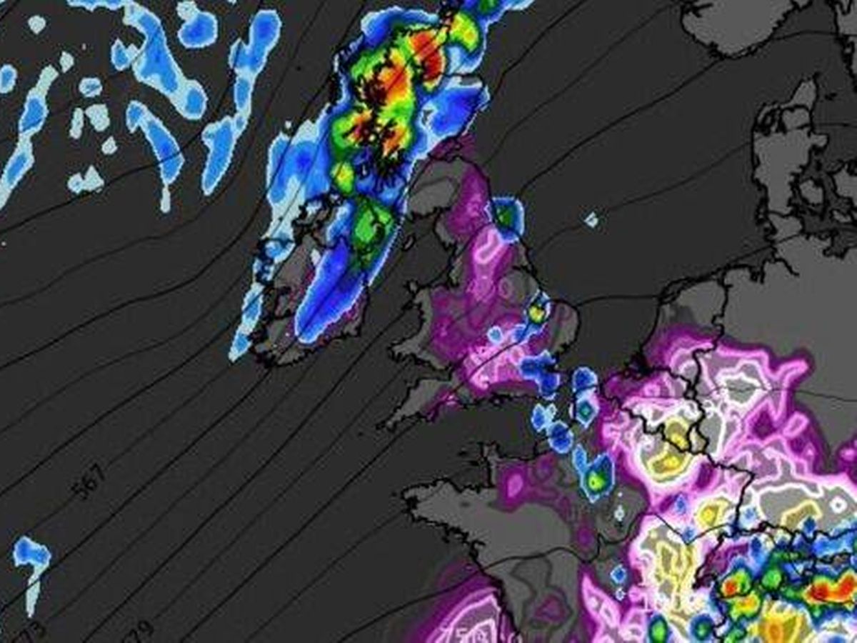
The UK is bracing for a barrage of violent lightning storms as the scorching 35C heatwave is set to break this week, new weather maps reveal. The latest forecast maps indicate that from Monday evening through to Wednesday, heavy rain and thunderstorms could sweep across the country, providing a much-needed respite from the stifling heat. Tomorrow (Monday, June 30) is tipped to be one of the warmest days of the year so far, with the Met Office forecasting temperatures well above 30°C in central and eastern England, potentially hitting 35C in London and towards Cambridge. However, emerging forecast maps from WXCharts depict a massive band of thunder and lightning storms following the heatwave, with rainfall expected to drench Scotland and northern England from 6pm on Monday. Looking ahead to Wednesday, another wave of fierce storms and lightning is predicted to roll in around 3pm onwards, with storms anticipated to batter most of the UK, as well as parts of France, Belgium and the Netherlands. The UK Health Security Agency (UKHSA) has issued an amber alert for high temperatures this weekend (starting on Friday), covering London, the East Midlands, South East, South West and East of England. The warning will remain in effect until 6pm on Tuesday. The UKHSA has advised UK households to stay cool by shutting windows and curtains in rooms that face the sun, reports the Express . The UKHSA has also issued a yellow alert for Yorkshire and Humber, as well as the West Midlands, for the same duration. The agency has warned of significant impacts on health and social care services. Monday could see temperatures soaring to 34C, a feat only achieved four times in June since the 1930s. The current June record, which might be broken, is 35.6C. This was first recorded at Southampton Mayflower Park on June 28, 1976, and again at Camden Square, North London, on June 29, 1957. An amber alert was previously activated for all regions in England on June 19, marking its first use since September 2023. On that day, Kew in west London experienced a high of 32.2C, before heatwaves were declared across England and Wales. An official heatwave is declared when areas hit a certain temperature for three consecutive days. The thresholds range from 25C to 28C in different parts of the UK. For today’s forecast, cloud cover in the south will gradually lift and clear this morning, paving the way for a very warm day with plenty of sunshine. It will be fresher in the north with brisk winds and some sunshine. Expect intermittent showery rain across Northern Ireland and western Scotland. Looking to tonight, Northern Ireland and Scotland will be cloudy with occasional drizzle. Elsewhere, it will remain dry with clear skies and rather warm conditions persisting through the night. On Monday, England and Wales can expect a sunny and hot day, with the potential for a few afternoon thunderstorms, particularly in northern England. Meanwhile, fresher conditions are forecasted for the northwest, accompanied by some heavy rainfall. Looking ahead to Tuesday through Thursday, Tuesday will see another hot day in the southeast, but a fresher feel is expected from the west. Temperatures will be closer to average on Wednesday and Thursday. The south could see heavy rain on Thursday. For the latest breaking news and stories from across the globe from the Daily Star, sign up for our newsletter by clicking here .