By Maria Leticia Gomes
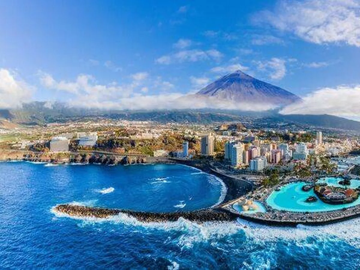
British holidaymakers jetting off to the Canary Islands from today are being warned to stay vigilant as Spain’s national weather agency, AEMET, issues new alerts for strong winds and a significant drop in temperatures across the popular tourist hotspot. This warning comes amidst a record-breaking heatwave in Spain and a fresh wave of illegal holiday homes being cleared from the country’s most renowned beaches following local backlash against overtourism. From Thursday, the islands will continue to enjoy generally sunny skies, but a light calima (haze) may linger over Gran Canaria and the eastern islands, potentially impacting air quality. Winds from the north to north-east are predicted to pick up as the week goes on, with very powerful gusts anticipated in certain areas – conditions that could pose a threat to outdoor activities and disrupt travel arrangements. The most intense gusts are expected to strike low-lying areas on the southeast and northwest slopes of Tenerife, as well as the more mountainous islands. Winds are also forecast to ramp up towards the evening each day, posing potential risks for beachgoers, walkers and motorists, reports the Express . In Lanzarote, potent gusts could impact the southeast during early mornings and evenings, while similar conditions are forecast for Fuerteventura’s southern Jandía massif. Tourists visiting these areas are advised to exercise extra caution, particularly around coastal zones and exposed routes. Gran Canaria is set to experience a slight dip in temperatures from Thursday, with the mercury still reaching 30-32°C in some sheltered southern areas but feeling chillier elsewhere. Strong winds are forecasted to intensify throughout the day, predominantly impacting the southeast and western lowlands. Over in Tenerife, there could be a moderate temperature decrease, particularly at mid-altitudes, accompanied by very strong gusts around the Anaga massif and the far northwest of the island. Maritime conditions are predicted to worsen as northerly winds escalate to force 4 or 5, locally peaking at 6 or 7, resulting in moderate to rough seas. On the southern coasts, lighter yet variable breezes will persist, while a northwesterly swell of up to 2 metres could cause reduced visibility and challenging navigation for boaters. AEMET has reissued its yellow warning for parts of the archipelago and advises tourists to regularly check weather updates, stay hydrated, and exercise extra caution if venturing into more exposed parts of the islands from Thursday onwards.